Port-au-Prince, Haiti (CNN) -- Tropical Storm Isaac strengthened slightly as it churned toward Haiti on Friday, threatening an already vulnerable nation with gale-force winds, pounding rain and the potential for life-threatening floods.
The storm is expected to make landfall Friday night. As of Friday evening, Isaac had maximum sustained winds of 65 miles per hour, up from 60 mph earlier in the day.
"It's going to be a brutal night," said CNN meteorologist Chad Myers.
As of 8 p.m. ET, Isaac was about 90 miles south-southeast of Port-au-Prince, Haiti's capital, and moving northwest at 10 mph, down from 16 mph earlier. The country was under a hurricane watch, according to the Miami-based National Hurricane Center.
Rainfall accumulations of 8 to 12 inches are expected, with maximum amounts of 20 inches possible over the island of Hispaniola.
"Our experience in Haiti clearly indicates that it is not the storm or the winds, it's the rain that causes the problems," said Sinan Al-Najjar, the Red Cross' deputy country representative in Haiti. "When rain comes, landslides and flash floods do happen in Haiti. We are trying to focus on which are the flood areas, which are the risk areas."


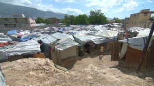
Hundreds of thousands of people left homeless by a devastating 2010 earthquake continue to live in camps.
With floodwater comes the risk of another outbreak of cholera, an infection of the large intestine that causes severe diarrhea.
"After floods, it's going to be almost certain that we see increases in cholera cases," Al-Najjar said. "We already witnessed that with the few weeks of rain we had in April. We had spikes due to daily rain. If a flood comes, we know certainly cholera is going to be an issue."
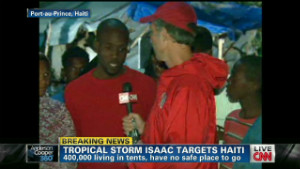
Many of the Haitians living in camps had no idea that a storm was coming, CNN correspondent Gary Tuchman reported from Port-au-Prince. Not until a translator told them that Isaac was nearing did people in the streets know of the storm's approach or that the government had opened some shelters.
Residents of one tent community said they were staying put with their belongings and would ride out the storm.
Haitian President Michel Martelly told CNN that he and his prime minister were traveling from camp to camp to encourage people to go to shelters, but they acknowledged not everyone would be able get out.
"Those who are very vulnerable, they are moved out of these camps. And the ones who are remaining behind are those who are stronger to fight this situation," he said.
Meanwhile, in Jacmel, a town in southern Haiti, there were no signs of hurricane preparations. The area suffered heavy flooding several years ago during another storm.
"I'm very worried about the water coming off the mountains and that the city fills up like a sink," said Hugues Paul, the mayor.
Large amounts of rainfall will cause mudslides and runoff that can block roads, or worse.
"We watch those storms every single time they come near because Haiti is so vulnerable," said Amy Parodi, a spokeswoman for the Christian humanitarian organization World Vision.
The agency has met with the government in previous summers to discuss contingency plans for major storms, and pre-positioned relief items are available, she said.
The storm is expected to move near or over Cuba on Saturday and approach the Florida Keys on Sunday. Tropical storm warnings and watches were in effect for parts of Cuba, while a tropical storm watch was issued for the Florida Keys.
Officials in Monroe County, in far south Florida, said three shelters would open Saturday for people who did not want to ride out the storm in their homes. They did not order a visitor evacuation as Isaac is forecast to cross the Florida Keys as a tropical storm, not a hurricane.
Isaac, which has already forced airline companies to cancel a couple dozen flights, should weaken as it moves through Haiti and Cuba.
The storm also poses a risk to the Republican National Convention in Tampa, Florida, which is set to start next week. Gov. Rick Scott said it will be up to organizers to decide the fate of the event.
While Isaac's path remains uncertain, the latest tracking information shows it crossing near the western Florida Keys and staying well west of Tampa, and not reaching hurricane strength until sometime Monday. A five-day projection shows Isaac making landfall near Pensacola, Florida, by early Wednesday.
Even though most of the state may catch a break, officials are taking the threat seriously.
"It has been a fortunate seven years since Wilma hit Florida," National Hurricane Center Director Rick Knabb said, referring to the last hurricane to make landfall in the state. "The luck is going to run out at some point."
No comments:
Post a Comment