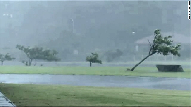
Tokyo (CNN) -- Okinawa emerged relatively unscathed on Monday from a ferocious typhoon that churned across the Japanese island before heading toward the Korean Peninsula.
Typhoon Bolaven had maximum sustained winds near its center of 185 kilometers per hour (115 mph) when it hit Okinawa on Sunday night, according to the Hong Kong Observatory, which monitors storms in the region.
That wind strength put Bolaven in the "super typhoon" category. And with a cloud field of 2,000 kilometers (1,250 miles), it is 20 times larger than Okinawa's length.
But the island, which is situated in an area of the western Pacific Ocean where typhoons are frequent, avoided the kind of destruction that some other storms have caused in East Asia this summer.
Five people were injured in Okinawa, the local authorities said, and 549 residents took shelter in public buildings to avoid potential damage to their homes. About 17,500 households lost electricity as the storm damaged power lines.
"It's been a long and rough night." the storm chaser James Reynolds said early Monday morning on Okinawa.
Tree branches were flying through the air amid torrential rain, said Reynolds, who was on the northwestern coast of the island during the worst of the typhoon.
"The eye of the typhoon actually crashed ashore just after dark," he said. "Like the rest of the population we all just kind of holed up in the strong and sturdy buildings which make up Okinawa."
The infrastructure on Okinawa is designed to withstand violent storms. "Everything's made of solid concrete," Reynolds said.
The damage was also limited because Bolaven didn't bring winds as powerful as initially feared, said Morichiyo Ohshiro, an official from the Okinawa Prefecture Disaster Prevention and Crisis Management Division.
North of Okinawa, the Amami Islands suffered a major power outage as a result of the typhoon. According to Kyushu Electric Power Corporation, which provides power to the area, 56,300 households were without power as of Monday morning.
All residents of about 2,540 households on Yoron, one of the islands in the chain, were advised by the local authorities to relocate to nearby public facilities as the storm made its way northward.
"It's the people in the Korean Peninsula who look like they've got to prepare for the incoming storm," said Reynolds.
As of early Monday afternoon, Bolaven was projected by regional meteorological agencies to move north and pass close to the west coast of the Korean Peninsula. It could make landfall Tuesday evening near North Korea's border with China.
President Lee Myung-bak of South Korea on Monday called on government agencies to take measures to minimize damage from the approaching storm, the national news agency Yonhap reported, citing Park Jeong-ha, a spokesman for Lee.
Taiwan, meanwhile, could be in for a pounding because of something called the Fujiwhara effect.
Typhoon Tembin made landfall in southern Taiwan a few days ago, and was expected to work its way toward Hong Kong. But Bolaven, which is much stronger, has stopped Tembin's movement toward Hong Kong and has been spinning it around. Tembin is likely to make a second landfall in southern Taiwan, on Tuesday morning.
"As Typhoon Bolaven moves northward towards the Yellow Sea, it will drag Tembin toward the China coast very near Shanghai," said CNN International meteorologist Tom Sater. "That's an amazing change in direction."

No comments:
Post a Comment